甜水海
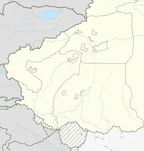
甜水海[2][3] 是中国人民解放军陆军的一处兵站[4][5] ,位于克什米尔的阿克赛钦地区,是解放军海拔最高的兵站。该地现由中国新疆维吾尔自治区的和田县实际控制。[6] 印度宣称对该地拥有主权,视其为拉达克的一部分。
| 甜水海 | |
|---|---|
| 兵站 | |
 | |
 甜水海 | |
| 坐标:35.297°N 79.561°E | |
| 国家 | |
| 自治区 | 新疆 |
| 县 | 和田县 |
| 海拔[1] | 4,850 公尺(15,910 英尺) |
甜水海并无甜水,仅有一滩盐碱湖,生活用水及物资依赖外地运输。“甜水”一名源自该站曾经的一名老兵“想喝口甜水”的遗愿。[7][8]
根据中华人民共和国的法律法规,兵站不允许外人进入,但在没有换防、训练等重要任务的前提下,该兵站会酌情对前来求助的旅行者给予一定程度的帮助。[9]

| 南疆军区在中印边境西段设置的边防连(哨所) | |||||||||||||||||||||||||||||||||
|---|---|---|---|---|---|---|---|---|---|---|---|---|---|---|---|---|---|---|---|---|---|---|---|---|---|---|---|---|---|---|---|---|---|
|
|||||||||||||||||||||||||||||||||

参考
- Anna Orton. . Epitome Books. 2010: 18– [2020-06-30]. ISBN 978-93-80297-15-6. (原始内容存档于2020-08-01).
The China National Highway 219 ... passes through no towns in Aksai Chin, only some military posts and truck stops, such as the very small Tianshuihai (el. 4,850 m (15,900 ft)) post.
- 6. Dorling Kindersley. April 2013: 150. ISBN 978-1-4654-0227-1 –Internet Archive.
Tianshuihai
- 3rd https://archive.org/details/collinsworldatla00harp. 2007: 82. ISBN 978-0-00-723168-3 –Internet Archive.
Tianshuihai
缺少或|title=为空 (帮助) - . TibetTour.org. [30 December 2019]. (原始内容存档于2019-12-30).
the last stop in Xinjiang, the tianshuihai(原文如此) Army Service Station, which is the highest Station in China. It is expensive to stay overnight at the Army Service Station, so we suggest that you camp nearby.
- . Lonely Planet 7. February 2008: 2,339 –Internet Archive.
Tianshuihai{...}From here the road turns south, and climbs to the Khitai Pass (kilometre marker 535; 5150m), past the military base of Tianshuihai.
- . . 29 April 2019 [23 December 2019] (中文(简体)).
- . [2020-06-30]. (原始内容存档于2020-08-04).
- . www.sohu.com. 2018-07-03 [2021-02-19]. (原始内容存档于2020-06-30) (中文).
- . www.buzhiqixing.com. 2019-03-11 [2021-02-19]. (原始内容存档于2021-01-20).
| 喀喇昆仑走廊和阿克赛钦的相关位置图 |
|---|
 3 7 10 12 16 19 22 24 31 32 34 36 37 38 51 57 喀喇昆仑走廊和阿克赛钦的相关位置图 图例:
|