捷克地理
捷克共和国的地形非常复杂,西部波希米亚是易北河(捷克語:)和伏尔塔瓦河流域,周围是山地,包括捷克最高峰,海拔1,602米的斯涅日卡峰,东部摩拉维亚地区是摩拉瓦河流域,也包括奥得河(捷克語:)的源头,捷克境内的河流分别流往北海、波罗的海和黑海。
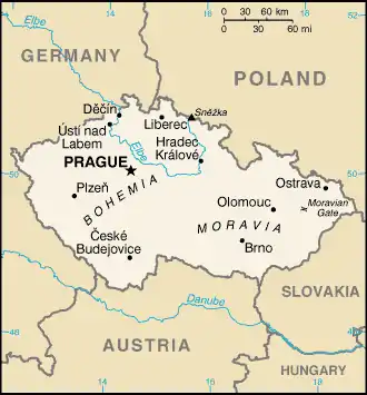
捷克是內陸國家。根据1929年的凡尔赛条约,德国易北河下游汉堡3万平方米的摩尔达乌港租借给捷克斯洛伐克,直到2028年,目前捷克继承了租借权。
捷克的卫星照片
This article is issued from Wikipedia. The text is licensed under Creative Commons - Attribution - Sharealike. Additional terms may apply for the media files.