风玫瑰图
风玫瑰图(wind rose plot)用来简单描述某一地区风向风速的分布,可分为风向玫瑰图和风速玫瑰图。在风玫瑰图的极坐标系上,每一部分的长度表示该风向出现的频率,最长的部分表示该风向出现的频率最高。风玫瑰图通常分16个方向,也有的再细分为32个方向。

常见于建筑施工图的风玫瑰图

美国纽约拉瓜迪亚机场的风玫瑰图(2008年)
歷史
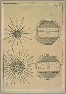
中世紀風玫瑰
在羅盤玫瑰存在之前,地圖上也包含一個玫瑰圖,讓讀者知道在平面圖中8種主要風(有時是8種半風和16種四分之一風)的方向。北方百合花飾,東方基督十字,以指示耶路撒冷的方向。[1][2]
参考资料
- Dan Reboussin (2005)Wind Rose. (页面存档备份,存于) University of Florida. Retrieved on 2009-04-26.
- Thoen, Bill. . GISNet. [2011-12-18]. (原始内容存档于2022-06-05).
| 维基共享资源上的相关多媒体资源:风玫瑰图 |
This article is issued from Wikipedia. The text is licensed under Creative Commons - Attribution - Sharealike. Additional terms may apply for the media files.