阿布萨罗卡岭
阿布萨罗卡岭(英語:)是美国洛磯山脈的一条子山脉,顺着蒙大拿州-怀俄明州的边界绵延150英里(240),最宽处达75英里(121),组成了黃石國家公園的东界。山脉共有46座海拔12,000英尺(3,700)以上的山峰。
| 阿布萨罗卡岭 | |
|---|---|
 从蒙大拿Livingston西部观望阿布萨罗卡岭的风光 | |
| 最高点 | |
| 山峰 | 弗朗克斯峰 |
| 海拔 | 13,153英尺(4,009) |
| 43°57′41″N 109°19′51″W | |
| 规模 | |
| 长度 | 150英里(240) |
| 宽度 | 75英里(121) |
| 地理 | |
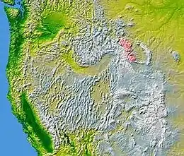 Absaroka Range is shown highlighted in pink on a map of the western United States
| |
| 国家 | |
| States | Montana和Wyoming |
| 山脈 | 洛磯山脈 |
| 边界 | Beartooth Mountains Wind River Range |
This article is issued from Wikipedia. The text is licensed under Creative Commons - Attribution - Sharealike. Additional terms may apply for the media files.