維多利亞山 (澳大利亞)
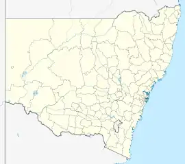
維多利亞山(英語:)是位於澳大利亞新南威爾斯州藍山[7]的一個小鎮。維多利亞山在地理上是大雪梨最西端的村莊和市區,位於藍山市之西部高速公路上,距離雪梨中央商業區西北偏西約120公里(75英里),海拔約1,052公尺(3,451 英尺)。[8]根據2011年人口普查的數據顯示,維多利亞山的人口為823人。[9]
| 維多利亞山 Mount Victoria | |
|---|---|
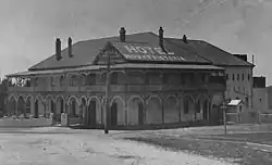 維多利亞山酒店(1920年代攝) | |
 維多利亞山 | |
| 坐标: 33°35′26″S 150°15′21″E | |
| 国家 | |
| 一级行政区 | 新南威爾士州 |
| 地方政府区域 | 藍山市[1] |
| 郡縣 | 庫克縣[1] |
| 建立 | 1866[2] |
| 海拔[3] | 1,043 公尺(3,422 英尺) |
| 人口(2016年普查)[4] | |
| • 總計 | 1,016人 |
| 郵政編碼 | 2786 |
| 位置 | |
| 堂區 | Hartley[1] |
| 州選區 | 藍山選區[5] |
| 聯邦選區 | 麥覺里[6] |
參考文獻
- . Geographical Names Register (GNR) of NSW. Geographical Names Board of New South Wales.
- Isles, Ebena. . Blue Mountains City Library: Mount Victoria & District Historical Society. 1988: Preface, 1.
- http://www.altitude.nu/ 的存檔,存档日期7 July 2012. Elevation at any place.
- Australian Bureau of Statistics. . 2016 Census QuickStats. 27 June 2017 [24 April 2018].
- . NSW Electoral Commission. [23 November 2019]. (原始内容存档于2023-04-12).
- . Australian Electoral Commission. [15 April 2009]. (原始内容存档于2011-03-09).
- Gregory's New South Wales State Road Map, Map 220, 11th Edition, Gregory's Publishing Company
- . The Age. Australia. 8 February 2004 [16 April 2009]. (原始内容存档于2016-03-10).
- Australian Bureau of Statistics. . 2011 Census QuickStats. 31 October 2012 [24 June 2013].
This article is issued from Wikipedia. The text is licensed under Creative Commons - Attribution - Sharealike. Additional terms may apply for the media files.