林厝港
林厝港(英語:),新加坡北區西北端的一個規劃區,位於西部集水區以東,雙溪加株以西及柔佛海峡以南,是新加坡比較未被發展的區域。
| 林厝港 | |
|---|---|
| 規劃區 | |
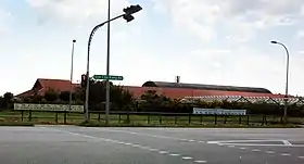  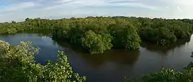  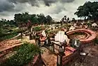 順時針方向:Koon Lee Nursery, Kranji Transmitting Station, Lim Chu Kang Road, Sungei Buloh Wetland Reserve, Chinese Cemetery Path 4, gravestones in Choa Chu Kang Chinese Cemetery | |
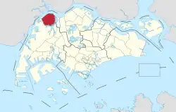 林厝港在新加坡的位置 | |
| 坐标:01°25′N 103°42′E | |
| 國家 | |
| 地區 | 北區
|
| CDC | |
| 市議會 |
|
| 選區 |
|
| 政府 | |
| • 市長 | 西南社区发展理事会
|
| • 國會議員 | 蔡厝港集選區
|
| 面积[1] | |
| • 总计 | 17.3 平方公里(6.7 平方英里) |
| 面积排名 | 13th |
| 人口(2018)[1] | |
| • 總計 | 110人 |
| • 排名 | 42nd |
| • 密度 | 6.36人/平方公里(16.5人/平方英里) |
| • 密度排名 | 43rd |
| Postal district | 24 |
This article is issued from Wikipedia. The text is licensed under Creative Commons - Attribution - Sharealike. Additional terms may apply for the media files.