托克满苏达坂
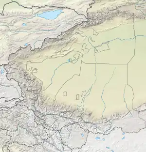
托克满苏达坂,又称为 托克满苏山口 [1]是兴都库什山脉—帕米尔高原中的封闭山口 ,位于阿富汗和中国在瓦罕走廊的边界。[2] 它位于小帕米尔东端的托克满苏河谷[3] 和中国新疆卡拉其古河谷之间。历史上,它是中国与瓦罕之间的三条路线之一。[4]在中国一侧,下方山谷中设有同名的边防连哨所。[5]
 非写实的马和鸟:来自于公元前 4 世纪塔吉克斯坦东帕米尔托克满苏一世墓。
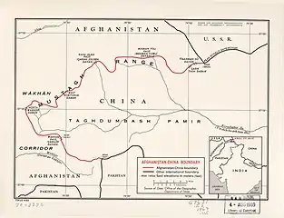 托克满苏达板位置圖,被標示成 TĪGARMAN SŪ DAVĀN(1969)[lower-alpha 1]
| 托克满苏达坂 | |
|---|---|
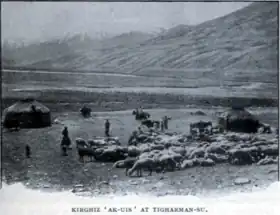 马尔克·奥莱尔·斯坦因拍摄 托克满苏达坂附近的柯尔克孜族营地 | |
| 海拔 | 4,827(15,837英尺) |
| 位置 | |
| 山脉 | 帕米尔高原 |
| 坐标 | 37°13′25″N 74°52′28″E |
 托克满苏达坂 | |
注记
- 来自于地圖: "名稱和邊界表示不一定具有官方性"
参考
-
 . 维基文库. 1963-11-22 (中文).
 托克满素达坂(阿方图称米赫满育里山口)...克克拉去考勒达坂(阿方图称铁盖满苏山口)
- . Aga Khan Foundation. Jan 2010 [2022-03-30]. (原始内容存档于2021-08-19).
side trip to Tegermansu (3-4 days one way from Chaqmaqtin Lake) and Kotal-e Tegermansu (4872m) on Afghanistan-China border, easternmost area of Little Pamir. Warning: All passes leading into Tajikistan and China are strictly off-limits to foreigners
- Tofel, Bartek. . American Alpine Journal: 253–255. 2010 [12 March 2022]. (原始内容存档于2021-04-22).
It took nine days to reach the easternmost part of the Wakhan Corridor and Afghanistan—the Tegerman Su Valley. ... Tegerman Su is a sensitive area: Kirghiz report the possibility of robbery by neighboring Tajiks. ... the Kirghiz did tell me about Tajik bandits stealing their animals at night.
- Malik, Hasan Yaser. . Fudan Journal of the Humanities and Social Sciences. 2014, 7 (2): 307–323. ISSN 1674-0750. S2CID 140705773. doi:10.1007/s40647-014-0017-z.
The narrow Wakhan Strip provides the following three routes -- The third one is the Central Route: linking both the Northern and Southern routes at Wakhan and further leading to China via Tegermansu Pass over a height of 4,827 m.
- . m.bljcn.com. 2018-08-31 [23 December 2019]. (原始内容存档于2019-12-23) (中文).
托克满苏边防站 如今的瓦罕走廊驻守着明铁盖边防7连、托克满苏边防8连、克克吐鲁克(科克吐鲁克)边防9连。
This article is issued from Wikipedia. The text is licensed under Creative Commons - Attribution - Sharealike. Additional terms may apply for the media files.