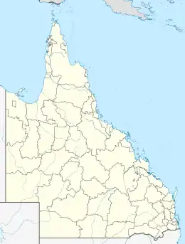
徹姆賽德區 (昆士蘭州)
彻姆赛德是個位於布里斯本市中心之北的市轄區。
| 彻姆赛德 | |
|---|---|
 | |
 彻姆赛德 | |
| 坐标:27°23′00″S 153°01′00″E | |
| 国家 | |
| 一级行政区 | 昆士蘭州 |
| 地方政府区域 | 布里斯本市 |
| 面积 | |
| • 总计 | 3.4 平方公里(1.3 平方英里) |
| 人口(2006年)[1] | |
| • 總計 | 6,348人 |
| • 密度 | 1,867人/平方公里(4,836人/平方英里) |
| 郵政編碼 | 4032 |
| 位置 | 10(6.2英里) (距布里斯本中央商業區north) |
| 城市 | 布里斯本 |
| 州選區 | 史達福 |
| 聯邦選區 | 立利 |
參考文獻
- 澳大利亚统计局. . 2006 Census QuickStats. 2007-10-25 [23 January 2011].
外部連結
- Chermside and Districts Historical Society
- University of Queensland: Queensland Places: Chermside and Chermside West (页面存档备份,存于)
- Queensland School opening and closing dates- C
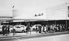
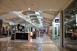
彻姆赛德的巴士站設於購物中心
This article is issued from Wikipedia. The text is licensed under Creative Commons - Attribution - Sharealike. Additional terms may apply for the media files.