塔村區
塔村區(英語:,ⓘ),意為“倫敦塔”(Tower)外的“村落”(Hamlets),是英國英格蘭大倫敦內倫敦的自治市,人口212,800,面積19.77平方公里,是英國最大的穆斯林社區[1],超過30%人口為孟加拉裔[2][3]。英國最大的清真寺东伦敦清真寺亦位於此區[4]。
| 塔村區 London Borough of Tower Hamlets | |||
|---|---|---|---|
| 自治市鎮(區) | |||
| |||
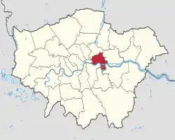 塔村區在大倫敦的位置 | |||
| 坐标:51°30′36″N 0°00′22″W | |||
| 国家 | |||
| 構成國 | |||
| 郡及區域 | 大倫敦 | ||
| 行政總部 | Clove Crescent, Blackwallt | ||
| 政府 | |||
| • 类型 | Leader & Cabinet | ||
| • 市長 | Shafiqul Haque | ||
| • 立法 | |||
| • 議員 | Jim Fitzpatrick George Galloway | ||
| • 倫敦議會成員 | 倫敦市與東區 John Biggs | ||
| 面积 | |||
| • 总计 | 19.77 平方公里(7.63 平方英里) | ||
| 面积排名 | 348 | ||
| • 排名 | (共354區) | ||
| ONS編碼 | 00BG | ||
| 種族 | 英國白人 愛爾蘭人 其他白人 白人-加勒比海黑人 白人-加勒比海非裔 亞裔白人 其他混血兒 印度人 巴基斯坦人 孟加拉人 其他亞裔 加勒比海黑人 非裔黑人 其他黑人 英籍华人 其他 | ||
| 網站 | www | ||
簡介
轄區鄰近倫敦市,屬商業區之一。在十九世紀至二十世紀中,轄區曾是倫敦對外貿易中心。自1960年代航運業衰頹,轄區逐漸轉型,成為金融中心區。
人口
轄區從十九世紀起,隨著對外貿易發展人口不斷上升。至1940年代人口共有489,956人[5]。然而在航運業衰微後,目前人口比高峰期少了約一半。
注釋
- . banglastories.org. [2021-08-17]. (原始内容存档于2021-05-25).
- Eade, John. . Metcalf, Barbara Daly (编). . Berkeley: University of California Press. 1996 [19 April 2015]. ISBN 0520204042.
As one of the few mosques in Britain permitted to broadcast calls to prayer (azan), the mosque soon found itself at the centre of a public debate about "noise pollution" when local non-Muslim residents began to protest.
- Garbin, David. "Bangladeshi diaspora in the UK: some observations on socio-cultural dynamics, religious trends and transnational politics" (页面存档备份,存于), Conference Human Rights and Bangladesh, School of African and Oriental Studies, June 2005, p. 1. Retrieved 16 August 2011.
- Tower Hamlets Council Corporate Research Unit, Religion in Tower Hamlets 2011 Census: Key Facts (Briefing 2013-03) 的存檔,存档日期5 August 2014.
- . A Vision of Britain Through Time. Great Britain Historical GIS Project. [2011-09-06]. (原始内容存档于2012-10-25).
This article is issued from Wikipedia. The text is licensed under Creative Commons - Attribution - Sharealike. Additional terms may apply for the media files.