卡马格
卡马格(法語:,法语发音:[kamaʁɡ];奧克語:)是一个位於法國南部阿尔勒附近的传统地区,地处罗讷河注入地中海處的三角洲地帶,也是法國少見的種植水稻的地區[3]。在行政區劃上,卡馬爾格的大部分地區屬阿尔勒管轄,因此阿尔勒成為法國面積最大的市。卡馬爾格可分為北部的農村地區和南部的濕地兩大地區,其中南部的濕地地區有鹽生植物生存,擁有很高的生態價值。1927年時,卡馬爾格就被劃為國立自然保護區。
| 指定保护地 | |
|---|---|
| 官方名称 | Camargue (卡马格) |
| 评定时间 | 1986年12月1日 |
| 參考編碼 | 346[1] |
| 官方名称 | La Petite Camargue (小卡马格) |
| 评定时间 | 1996年1月8日 |
| 參考編碼 | 786[2] |
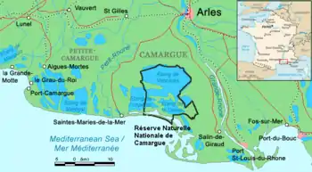
卡马格地图
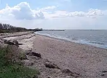
瓦卡雷斯湖(Étang de Vaccarès)
參考資料
This article is issued from Wikipedia. The text is licensed under Creative Commons - Attribution - Sharealike. Additional terms may apply for the media files.