南射纹线坑
南射纹线坑(South Ray)是阿波罗16号宇航员从月球表面所拍摄笛卡尔高地上的一座小陨石坑,1973年该陨坑名被国际天文学联合会正式接受[1]。
| 南射纹线坑 | |
|---|---|
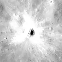 阿波罗16号拍摄的照片,右上方是巴比射纹线。 | |
| 直径 | 700米[1] |
| 深度 | 143米 |
| 命名来源 | 宇航员命名特征 |
阿波罗16号”猎户座“号登月舱于1972年4月21日降落在北射纹线坑和南射纹线坑之间。宇航员约翰·杨和查尔斯·杜克驾驶月面考察车或月球漫游车,在三次舱外活动中探索了二座陨坑之间的区域,其中第二次舱外活动最接近南射纹线坑—位于着陆点南面3.9公里处的4号科考点(钦科坑),在那杜克用500毫米镜头相机拍摄了南射纹线坑。
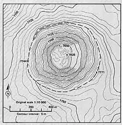
根据阿波罗16全景相机照片加工的南射纹线坑地形图,虚线表示陨坑边缘。
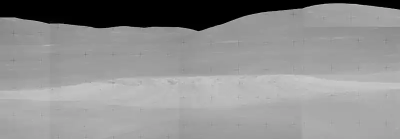
阿波罗14号拍摄的侧视图,面朝东。
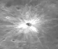
南射纹线坑直径约700米,深约120米[3],带有明亮的射纹系统的喷出物。宇航员们观察到,南射纹线坑的喷出物全都是很大巨砾,他们报告说在那里很难或无法驾驶月球车[4]。
外部链接
- 阿波罗16号的行程路线(页面存档备份,存于), 美国宇航局月球照片 78D2S2(25)
参考文献
- South Ray, Gazetteer of Planetary Nomenclature, International Astronomical Union (IAU) Working Group for Planetary System Nomenclature (WGPSN)
- Apollo 16 Lunar Surface Journal (页面存档备份,存于), Station 4
- Apollo 16 Landing Area (页面存档备份,存于), 78D2S1(50), NASA Lunar Topophotomap. Published by The Defense Mapping Agency, November 1974. Available from Lunar and Planetary Institute.
- Apollo 16 Preliminary Science Report (页面存档备份,存于) (NASA SP-315), 1972
- Geologic Map of the Apollo 16 (Descartes) Landing Area (页面存档备份,存于) by Apollo Field Geology Investigation Team (D. P. Elston, E. L. Boudette, J. P. Schafer), United States Geological Survey, April 1972
This article is issued from Wikipedia. The text is licensed under Creative Commons - Attribution - Sharealike. Additional terms may apply for the media files.